Trail Walking San Martin de Tor - San Martino in Badia - St. Martin in Thurn - Vom Würzjoch um dem Peitlerkofe - Photo
© OpenStreetMap contributors
Length
Length
13.4 km
Max alt
Max alt
2357 m
Uphill gradient
Uphill gradient
607 m
Km-Effort
Km-Effort  
22 km
Min alt
Min alt
1959 m
Downhill gradient
Downhill gradient
607 m
Boucle
Boucle
Yes
Creation date :
2025-07-27 08:01:30.021
Updated on :
2025-07-30 18:59:11.686

(0 Reviews)

Walking
Walking
5h55
Difficulty : Difficult

Scan this QR Code to open this trail in the SityTrail application

FREE GPS app for hiking

Logo SityTrail SityTrail

IGN / Geographical institutes

Download SityTrail from the App Store Download SityTrail from Google Play

Logo SityTrail SityTrail Plus

The world is yours!

Download SityTrail from the App Store Download SityTrail from Google Play Download SityTrail on Huawei AppGallery

About

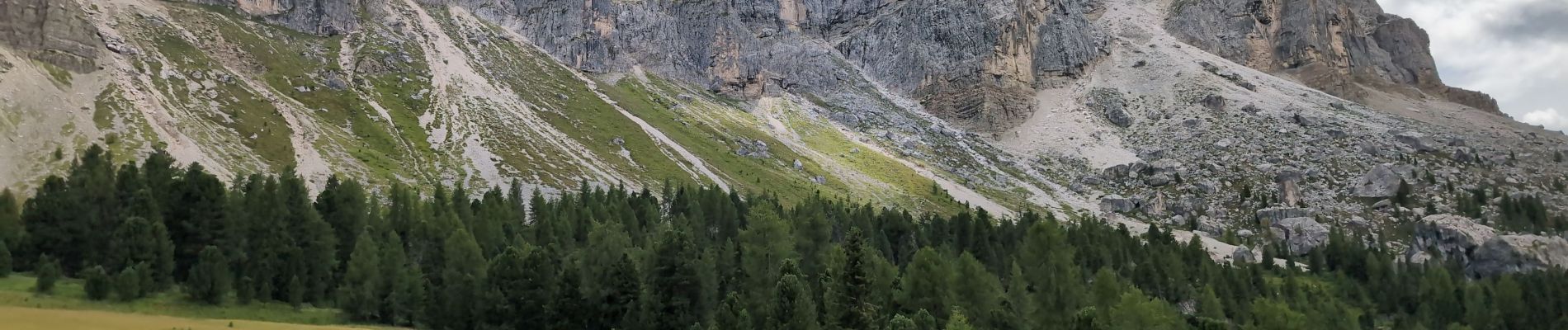
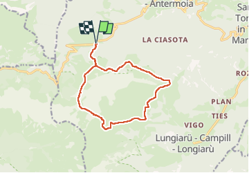
Trail Walking of 13.4 km to be discovered at Trentino-Alto Adige/Südtirol, South Tyrol, San Martin de Tor - San Martino in Badia - St. Martin in Thurn. This trail is proposed by VacheKiri67.

Description

Faite le 27/07/2025 avec nos amis Francine et Christian. D'après "Wandern in Südtirol - 16 : Vom Würzjoch um dem Peitlerkofe". Durée indiquée pour le circuit : 5h15.  Le parking est limité au Würzjoch (Passo del Erbe), il faut donc y arriver tôt.

Elevation profile

Photos

85 photos in total. Please click on a photo to see them all in the gallery.

Positioning

Country:
Italy
Region :
Trentino-Alto Adige/Südtirol
Department/Province :
South Tyrol
Municipality :
San Martin de Tor - San Martino in Badia - St. Martin in Thurn
Location:
Unknown
Start:(UTM)
715235 ; 5172900 (32T) N.


Close
My subscriptions